Gallery / Maps & polygons
map
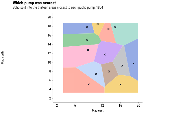
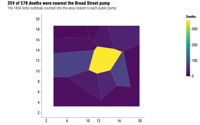
Snow's outbreak by nearest pump
The same thirteen Soho neighbourhoods, shaded by the cholera deaths inside each. One region holds 359 of the 578, and it is the one around Broad Street.
Source
Svelte, builder, JSON
<script lang="ts">
  import {
    CoordFixed,
    GeomMap,
    GGPlot,
    Labs,
    ScaleFillContinuous,
    ThemeClassic,
  } from "@ggsvelte/svelte";

  import { neighbourhoodDeaths, pumpNeighbourhoods } from "./data.js";
</script>

<GGPlot
  data={neighbourhoodDeaths}
  aes={{ map_id: "pump", fill: "deaths" }}
  width={640}
  height={400}
>
  <ThemeClassic />
  <CoordFixed />
  <ScaleFillContinuous scheme="viridis" />
  <Labs
    title="359 of 578 deaths were nearest the Broad Street pump"
    subtitle="The 1854 Soho outbreak counted into the area closest to each public pump"
    fill="Deaths"
  />
  <GeomMap
    map={{ values: pumpNeighbourhoods }}
    mapId="pump"
    linewidth={1.2}
    alpha={0.95}
  />
</GGPlot>
Meta
Details
- Family
- Maps & polygons
- Source
map/choropleth- Rendering
- SVG
- Techniques
Related